Back to the main LibreAtlas Wiki page
Few basic notices you must absolutely know about LibreAtlas databases
Technically speaking any LibreAtlas database simply is a SQLite db-file internally storing SpatiaLite and RasterLite tables.In other world, it's like a big repository containing both vector and raster data. Don't be fussed by the word Spatial Database.
It's nothing too much complex; it simply is a useful system allowing to store and retrieve geographic informations in a quick and very efficient way, nothing more than this.
Spatial Is Not Special: geographic sofware simply is a specialized version of general purpose software, there isn't absolutely nothing magic or extraordinary in this.
Simply a very basic preliminary knoledge about general computing (and about Geography, quite obviously) is expected from you as a pre-requisite.
Any LibreAtlas database internally contains several datasets: some of them are of the vector type, others are of the raster type.
All them share anyway some common features. We'll now quickly examine several interesting facets, using the WorldAtlas as a specific reference.
Coordinate Reference System
The supported SRS always is WGS84, as formally identified by the EPSG standard SRID 4326.This CRS is one of the geographic type, i.e. it's based on Latitude and Longitude measured angles.
Spatial Resolution (Nominal Scale)
The supported nominal scale for each dataset is one well fit for global world representations.It typically is about 30 arc seconds, this roughly corresponding to 1 Km on the Equator.
Supported vector datasets
The following datasets (aka layers) of the vector type are always included on every LibreAtlas database:- Towns: about 23.000 towns are represented.
Theorically every world populated place presenting more then 15,000 inhabitants is included.
The original source for this dataset is GeoNames (released under the CC-BY license terms). - Countries: about 250 countries are represented.
The original source for this dataset is World Borders (released under the CC-SA-BY license terms).
Flags and Emblems are taken from Wikipedia (and usually are in the Public Domain). - All the remaining vector datasets come from NaturalEarth (Public Domanin); they namely are:
- MarineAreas: about 300 marine areas (sea, ocen and alike) are represented.
- LandAreas: about 850 land areas (mountain ranges, plains, peninsulae, basins and alike) are represented.
- Lakes: about 3,300 lakes (lagoons, reservoirs and alike) are represented.
- Rivers: about 7,700 rivers are represented (higher detail available on North America and Europe; the same is for Lakes).
Supported raster datasets
The following datasets (aka layers) of the raster type may be included on a LibreAtlas database (depending on actual version / configuration):- Satellite imagery: this actually corresponding to TrueMarble (relased under the CC-BY license terms).
TrueMarble is a selected mosaic of orbital images taken from Lansat7 NASA/USGS satellite.
Two different versions of TrueMarble are supported:- a low-resolution version (smaller size), corresponding to 1 arc minute i.e. 2 Km.
- an enhanced-resolution version (bigger size), corresponding to 30 arc seconds i.e. 1 Km.
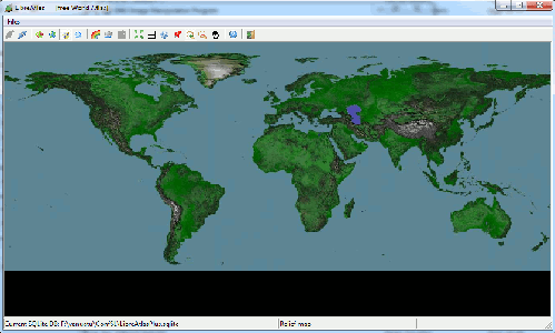
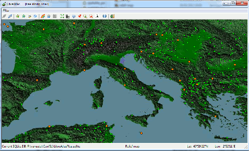
- Relief imagery: this actually corresponding to SRTM30 Digital Elevation Model. (Public Domain).
The original measured elevations were produced by the NASA/USGS Space Shuttle Radar Topography Mission.
This dataset has a spatial resolution of 30 arc seconds i.e. 1 Km.
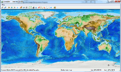
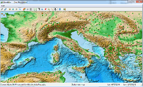
Actual imagery was then obtained by the Author itself by applying false colours and shaded relief rendering techniques. - Bathymetry imagery: this actually corresponding to ETOPO-1 Digital Elevation Model. (Public Domain).
This dataset has a spatial resolution of 1 arc minute i.e. 2 Km.
It represents a careful collection of historical measures (coming form many sources), and offers a detailed representation of seabeds and submarine orography.
Actual imagery exactely corresponds to pre-rendered imagery make available by NOAA. - Mean Temperature and Precipitation imagery.
Both climatic datasets come from WorldClim.
The original values were calculated on a per-month basis by processing many historical measures ranging from year 1950 to 2000.
This dataset has a spatial resolution of 30 arc seconds i.e. 1 Km.
LibreAtlas supports four monthly shapshots for each dataset: January, April, July and October.
Very bad notice; it's real sad to say, but the original license terms explicitly forbid redistribution to third parties.
So both climatic datasets are actually well supported by LibreAtlas, but are practically unavailable due to licensing constraints.
| Visual Examples | ||
|---|---|---|
| dataset | World Coverage | Regional Detail |
| Political map (vector layers) |
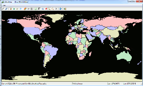
|
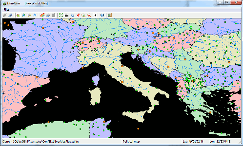
|
| Satellite map (TrueMarble) |
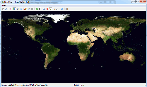
|
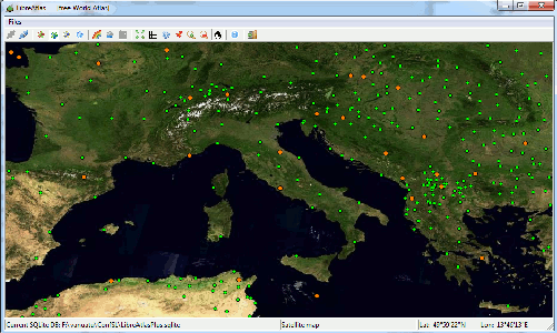
|
| Relief map (SRTM30) |
|
|
| Bathymetry map (ETOPO-1) |
|
|
| Temperature map |
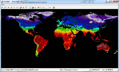 January |
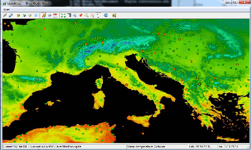 October |
| Precipitation (rain) map |
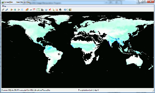 April |
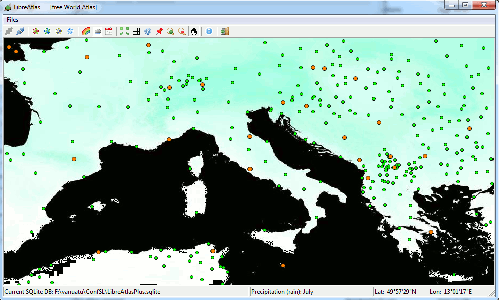 July |
LibreAtlas database editions
- LibreAtlasLight: the light-weighted edition (about 120 MB).
- all vector layers
- TrueMarble (2 Km)
- ETOPO-1 (2 Km)
- LibreAtlas: the standard edition (about 280 MB).
- all vector layers
- TrueMarble (1 Km)
- SRTM30 (1 Km)
- ETOPO-1 (2 Km)
- LibreAtlasPlus: the enhanced edition (about 600 MB).
including WorldClim climatic datasets; not currently avaible, due to licence issues.- all vector layers
- TrueMarble (1 Km)
- SRTM30 (1 Km)
- ETOPO-1 (2 Km)
- Mean Temperature (1 Km)
- Precipitation (1 Km)